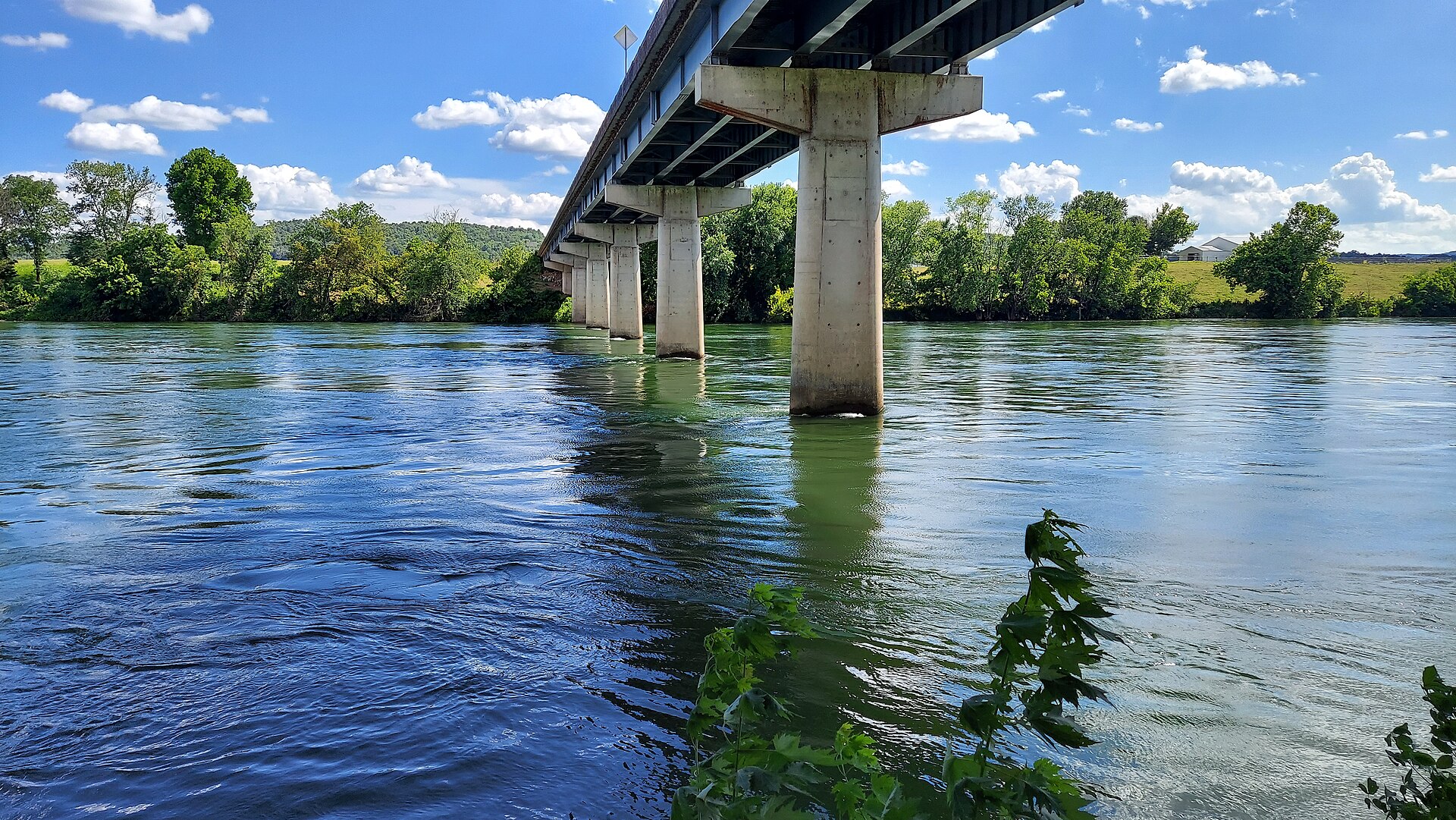
Quick reference
| Field | Value |
|---|---|
| State / region | Arkansas, north-central Arkansas below Bull Shoals Dam |
| Species | Rainbow trout, brown trout, brook trout, cutthroat trout |
| Best months | Year-round; late fall through early spring for the largest browns |
| Water type | Tailwater |
| Difficulty | Intermediate — easy fishing at low flows, but generation changes and boat logistics demand attention |
| Wading | Limited to shoals and park areas at low flow; dangerous during power generation |
Why fish here
The White River below Bull Shoals Dam is a large Ozark tailwater with roughly 90-plus miles of trout water, sustained by cold releases from Bull Shoals Lake all the way downstream to the Highway 58 bridge at Guion. It is widely regarded as one of the premier trophy brown trout fisheries anywhere, with documented fish well over 20 pounds and the realistic possibility of 30-plus-pound browns in the system. That top-end potential sits on top of extremely high trout densities — local accounts describe thirty-fish days as common over long stretches, particularly for rainbows and smaller browns.
The other draw is the calendar. There is no closed trout season, no snowmelt runoff, and no winter freeze-up: the river fishes every month of the year. Cold, clear water holds four trout species — rainbow, brown, brook, and cutthroat — under protective size and bag limits that maintain both numbers and quality for wade and boat anglers alike.
The structural reality shapes how you fish it. Public access concentrates at 25 established ramps and parks, with mostly private banks between them, so much of the river is best covered by drift boat or johnboat. Flows swing quickly with power generation, and the generation schedule — not the weather — is the variable that decides whether a given day is a wading day, a boat day, or a stay-home day.
The river, section by section
Bull Shoals Dam to Bull Shoals-White River State Park (catch-and-release reach)
Access: Bull Shoals Dam tailwater (no fishing in the first 100 yards below the dam); Bull Shoals-White River State Park access and trout dock; the Bull Shoals Catch-and-Release Area is signed along the park. Character: Broad, relatively gentle gradient with powerful mid-river currents during generation; long, even runs with shelves, shoals, and deep troughs rather than pocket water. Species mix: Primarily rainbow and brown trout, including occasional 20–25-pound browns; all four trout species present. Crowding: Heavily pressured — consistent weekend and holiday crowds, moderate weekday pressure, guided boat traffic through the winter and spring trophy periods. Notable hatches: Midges year-round; sulphur/PMD mayflies in late spring and early summer; caddis in spring; scuds and sowbugs as constant forage.
This is the river's most regulated and most famous water. Trout must be released immediately, only artificial lures with a single barbless point (or single barbless treble) are legal, and bait and chumming are prohibited. The reach runs catch-and-release February 1 through October 31 and closes entirely November 1 through January 31 down to the wing dike at the park trout dock — a spawning-protection closure worth building a winter trip around, not into. Wading is possible on low flow near shore shoals and park access areas, but generation turns this water dangerous quickly.
Bull Shoals-White River State Park to the Cotter area
Access: State park boat ramps and multiple public accesses along the first ~30 miles of tailwater, including ramps near Cotter referenced on Arkansas Game and Fish Commission maps; private banks between points push most anglers onto boats. Character: Wide tailwater with long pools and gentle runs separated by shallow shoals; flows change fast with generation, and gin-clear water in low-generation periods demands stealth and light tippet. Species mix: High densities of stocked and wild rainbows, good numbers of browns throughout, occasional brook and cutthroat trout. Crowding: One of the river's most popular stretches, with multiple guide services producing substantial boat traffic on popular weekends and prime flows. Notable hatches: Midges all year; sulphur/PMD-type mayflies late spring into early summer; caddis in spring; scuds, sowbugs, and small baitfish behind them.
If the White River has a heart, it is this reach — the thirty-fish days come from here. Most anglers cover it by drift boat or motorized johnboat, wading the shoals during low water. When generation drops and the water goes gin-clear, the fishing shifts from opportunistic to technical: small midges, mayfly emergers, and long, light leaders. Weekdays and non-holiday windows keep the pressure manageable.
Middle tailwater (Cotter downstream toward Calico Rock)
Access: Public access points and boat ramps spaced along the middle of the 92-mile tailwater; AGFC counts 25 public access points across the reach, many with ramps, with predominantly private banks between them. Anglers typically trailer between ramps and fish long drifts. Character: Large, open water — broad pools and long glides broken by distinct shoals and mid-river bars; modest gradient, strong mid-channel current during generation. Species mix: Abundant rainbows and solid numbers of browns, including potential trophies, under the same tailwater regulations down to Guion. Crowding: Less bank pressure than the upper river given limited walk-in access; regular guide and private-boat traffic in spring and fall, quieter weekdays outside peak seasons. Notable hatches: Midges as the year-round staple, with seasonal mayflies and caddis adding dry-fly windows; scud, sowbug, and small-nymph imitations effective most of the year.
This is essentially a boat fishery when multiple generators run, and the long drifts between ramps reward anglers who plan floats around the generation schedule rather than fighting it. The trade for the extra logistics is space: mid-river water that sees a fraction of the pressure concentrated at the dam and the park.
Lower cold-water tailwater (downstream toward the Highway 58 bridge at Guion)
Access: Scattered public access points and ramps within the AGFC-managed tailwater, ending at the Highway 58 bridge at Guion; intermediate banks are mostly private. Character: Broad river with long, slow glides and deep pools; flows remain generation-dependent, and wading is limited to specific shoals at low water. Species mix: The trout management zone extends to Guion with rainbow, brown, brook, and cutthroat trout; warmwater species become more common as the water warms farther downstream. Crowding: Generally the lightest pressure on the trout water, though cool-month weekends draw anglers targeting larger browns moving through the system. Notable hatches: Midges remain important, with periodic mayfly and caddis activity; scuds, sowbugs, and baitfish patterns carry the subsurface game.
The far-downstream water is transition country — still cold enough for trout, but trending toward a mixed fishery. It suits anglers chasing solitude and migrating browns more than numbers.
Hatches and seasons
| Months | Hatches | Flies |
|---|---|---|
| Jan–Feb | Midges, scuds, sowbugs; worm and egg patterns around winter flows and spawning | Zebra Midge #16–20, CopperHead Midge #18, Trout Crack #18, tungsten beadhead Woolly Bugger #8 fished low and slow |
| Mar–Apr | Midges and early caddis; building mayfly activity; strong scud/sowbug feeding | Zebra Midge #18–20, Trout Crack #18, Crackleback in sulphur/PMD colors #16, tungsten BH Woolly Bugger #8 for high water |
| May–Jun | Sulphur/PMD-type mayflies, caddis, steady midges; good dry-dropper windows | Crackleback #16 in sulphur/PMD, small mayfly emergers #16–18, Zebra Midge #18 dropper, slim scuds and sowbugs #14–18 |
| Jul–Sep | Midges all day; sporadic mayflies and caddis; terrestrials on low flows; streamers at first and last light | Zebra Midge #18–20, tungsten BH Woolly Bugger #8 black/olive, small attractor nymphs #14–18, ants and beetles #12–16 on calm edges |
| Oct–Dec | Midges, scuds, sowbugs, occasional late caddis/mayflies; prime streamer season for big browns | Tungsten BH Woolly Bugger #8 black/olive/brown, CopperHead Midge #18, Trout Crack #18, larger articulated streamers on sinking lines |
Recommended flies (by season)
| Season | Top patterns | Why |
|---|---|---|
| Spring | Zebra Midge #18–20, Crackleback #16 in sulphur/PMD colors, Trout Crack #18, tungsten BH Woolly Bugger #8 | Spring brings strong midge, caddis, and mayfly activity; these match the prevalent small insects, while the Bugger covers rising flows and actively feeding trout. |
| Summer | Zebra Midge #18–20, small mayfly nymphs and emergers #16–18, scuds/sowbugs #14–18, light Cracklebacks #16 | Cold tailwater temperatures persist all summer, keeping trout on tiny midges, mayflies, and crustaceans; small, precise nymphs win over selective fish in clear water. |
| Fall | Tungsten BH Woolly Bugger #8, CopperHead Midge #18, Trout Crack #18, larger streamers and egg patterns | Cooling water puts pre-spawn browns on streamers, eggs, and worms, while midges and small nymphs keep producing numbers. |
| Winter | Zebra Midge #18–20, CopperHead Midge #18, Trout Crack #18, slim scuds/sowbugs #16–18, dark Woolly Buggers #8 fished slowly | Stable, very cold water keeps trout feeding steadily on midges and bottom invertebrates; small patterns presented low and slow produce all winter. |
Gear notes
A 9-foot 5- or 6-weight with a floating line covers nymphing, indicator rigs, and moderate streamers; step up to a 6- or 7-weight for throwing large streamers at big browns and for controlling fish in heavy generation flows. Run long leaders — 9 to 12 feet, tapering to 4X–6X — and go lighter in the gin-clear low-flow conditions this system is known for. For wading, studded boots and a staff are the right call: the bottom mixes slick rock and shifting gravel, and generation changes can make a wadable shoal unsafe in minutes. Many regulars simply fish from boats for most of the river.
Logistics
- Regulations: Managed by the Arkansas Game and Fish Commission (AGFC). From 100 yards below Bull Shoals Dam to the Highway 58 bridge at Guion, a fishing license plus a trout permit are required (under-16 exempt). Daily limit is five trout with species caps: two brook trout 14 inches or longer, one brown trout 24 inches or longer, two cutthroat 16 inches or longer. The Bull Shoals Catch-and-Release Area (100 yards below the dam to the signed upstream boundary of the state park) is artificial-lure, single-barbless only, catch-and-release February 1–October 31, and closed November 1–January 31 down to the wing dike at the park trout dock. No fishing, boating, or wading in the first 100 yards below the dam. Regulations change annually — verify current AGFC trout-zone rules.
- Access points:
- Bull Shoals Dam tailwater — primary upper access; the first 100 yards below the dam are closed, with the catch-and-release reach beginning below
- Bull Shoals-White River State Park trout dock — major public access with boat ramp at the downstream end of the catch-and-release area; the main departure point for floats and low-flow wading
- Closest fly shop: White River Inn, Cotter area
- Nearest towns: Bull Shoals, Cotter, Gassville, Mountain Home, Calico Rock, Guion
- Closest gauge: USGS 07057370 — White River near Norfork, AR — sits below the North Fork confluence, so readings include Norfork tailwater flow and run above the Bull Shoals release alone; for the water right under the dam, the generation schedule is the better guide
When NOT to fish here
The White River never blows out in the freestone sense and has no closed season, so the limiting factor is power generation. When multiple generators run, flows get very high, wading becomes impossible, and even boat positioning turns difficult — check the generation schedule before every trip and build the day around it. Also plan around the November 1–January 31 closure of the upper catch-and-release water below the dam. Finally, peak weekends, holidays, and the cool-season trophy windows bring intense boat and guide traffic to the upper reaches; if that spoils the experience, fish weekdays or drop to the middle and lower river.
Where to fish next
- Fly Fishing in Arkansas — the full state guide
- Norfork Tailwater (North Fork River) — a major Bull Shoals-system trout tailwater with its own big-brown reputation, minutes from Mountain Home
- White River below Beaver Dam — the upper system's tailwater in northwest Arkansas, a smaller-scale alternative